The Geographic Information System (GIS) team has transitioned from Facilities Management to UIT’s University Support Services.
The GIS team gathers, analyzes and displays different layers of spatial information visually, and translates it on the U’s various campus maps. From navigation in our vehicles to weather modeling to population dynamics on a global scale, GIS incorporates technologies related to GPS, satellite imagery and remote sensing.
The strategic decision to integrate University GIS into UIT is based on several factors. Quality Assurance (QA) Director Dan Thornley, who is currently serving a dual role as interim UGIS product manager, said that the demand for GIS services at the U has grown significantly since its inception.
“I look at GIS as Business Intelligence on steroids, because instead of simply collecting data, information and reports, it adds graphics to it and makes it very visible and understandable,” Thornley said.
In 2008, Facilities Management established a GIS team to collect and maintain utility-related spatial/geographic data about campus buildings. But as requests for university-wide GIS services grew, the burden on FM’s financial and staffing resources became unsustainable, leading to an agreement between key university stakeholders in the fall of 2018 to shift backend support for GIS to UIT.
“GIS is an IT field. It’s a very technical, engineering-based discipline, and it really belongs in a place like this with the resources to do any sort of integration with UIT systems,” said Brett Archuleta, GIS systems administrator/developer.
Moving technical components and housing GIS staff in UIT, Thornley said, takes advantage of the organization’s robust infrastructure, processes and support capabilities. UIT, Thornley added, is uniquely positioned to maximize the value and availability of existing GIS platforms, licenses and technology, and enable future expansion of GIS technologies on campus.
Thornley is the chair of a UGIS subcommittee of the university’s Architecture and New Technology Committee (ANTC) that will review, prioritize and strategically guide GIS decision-making at the U. Membership is currently being filled under the direction of ANTC.
Cutting-edge projects like these, Thornley said, make GIS such an exciting field to work in.
“GIS has been around for many years, but it also has a long future ahead of it, especially in a higher education environment,” he said.
Archuleta added, “there’s always something changing on campus, always something going on that requires us to simulate it in a map application. It’s a dream for any sort of developer to have so many different features to home in on.” Here’s a look at some GIS projects and initiatives at the U.
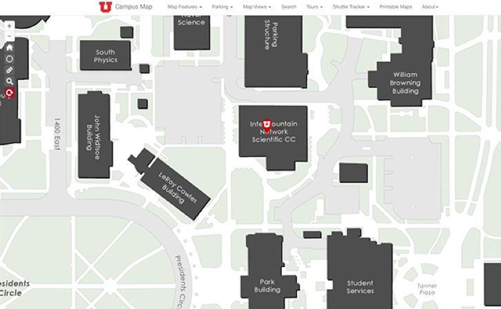
Campus map
Solving a longtime need, the latest iteration of the online campus map was created in 2014 in a partnership between University Marketing and Communications and the FM-GIS team. The campus map remains the U’s most utilized GIS application.
Network map
A collaboration between FM-GIS and UIT, this map features an overlay of network equipment on a campus map, allowing a quick health check of wireless connectivity. UGIS also maintains maps of distributed antenna systems and network fiber lines. These applications are not public-facing.

Hospital wayfinding
Working with the University Hospital, the FM-GIS team launched an interactive wayfinding application that allows users to pan and zoom into each building level, select features for more information, and view content for various clinics and departments.

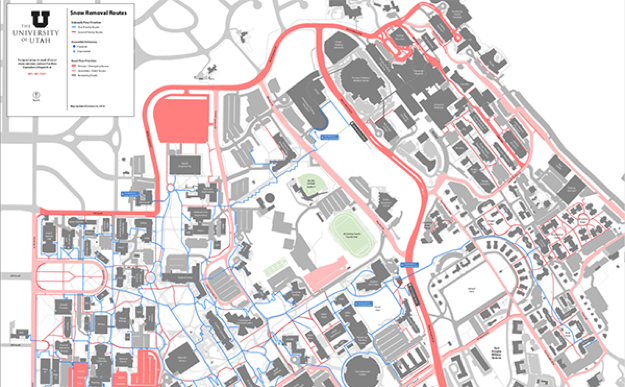
FM web app and mapping
The U’s GIS team works closely with FM staff to collect information about various campus assets that FM manages, using ArcGIS Online tools like vegetation mapping, plow zones, irrigation data and district mapping. The map above shows snow removal routes.
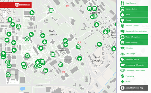
Green map
The green map was created through a partnership between the U’s Sustainability Resource Center and FM-GIS team. It highlights sustainability projects, installations and green infrastructure on campus.
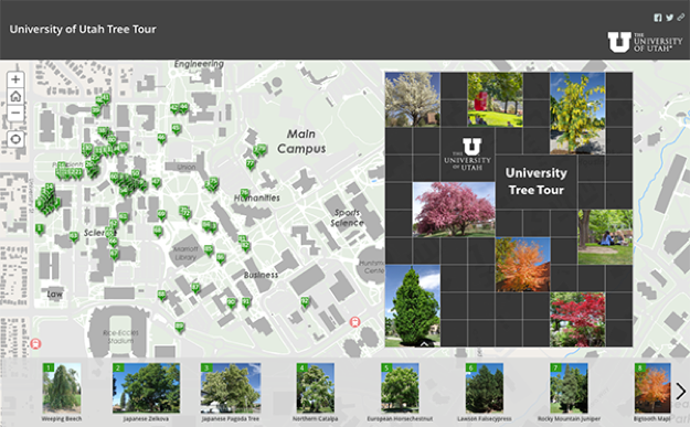
Tree tour
FM-GIS leveraged ArcGIS Online tools to build a series of applications that give grounds crews location and health information for every tree on campus. The app was designed to highlight a handful of the many species and varieties of trees found on campus.