The good news in the wake of the Bonneville Fire, which blackened the Wasatch foothills behind the University of Utah campus last month, is that the flames did not damage soils, dampening the potential for post-fire erosion and flooding.

The denuded hills, however, will remain at elevated risk of debris or mud flows for up to three years while vegetation recovers, according to an assessment prepared by the U.S. Forest Service known as a Burned Area Emergency Response, or BAER.
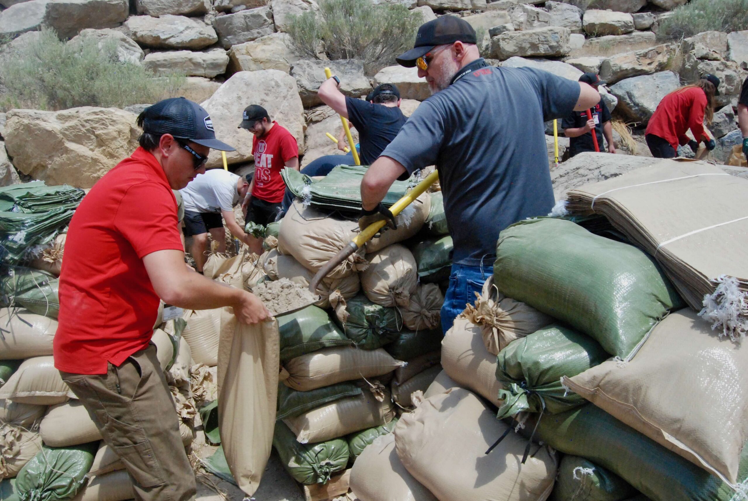
To contain the potential damage from such flows, university officials have placed Jersey barriers and 2,000 sandbags along the Bonneville Shoreline Trail, with the help of more than 100 volunteers from the U community. With the approach of the monsoon season and rain in the forecast, that action will reduce the chances of rain-entrained debris reaching Huntsman Cancer Institute’s hospital and research facilities immediately below the burned area.
Officials have placed concrete Jersey barriers along 700 feet of the Red Butte and Bonneville Shoreline trails above HCI, according to Phil Chaffee, the U of U Health’s associate executive director of emergency management.
“Today we’re loading the sandbags so we can also place those,” Chaffee told reporters gathered at staging area on Thursday. “These barriers and sandbags are not intended to stop the water. It’s intended to redirect and slow the flow of the water so our storm drains can actually manage the level of flow and runoff. In addition to storm drains is down at the facilities themselves at Huntsman Cancer Hospital and Institute. We have 3-foot high block walls that should it get down to that area would help to contain to allow the storm drains to handle the flow. So I think we’re positioning ourselves in as best of a position as we could be in if these monsoonal flows were to play out.”

The Bonneville fire was triggered on June 20 by human activity and scorched 572 acres, or just under a square mile, over a few days. Quick action by firefighters prevented flames from spreading into a nearby neighborhood.
The burned area spans Mt. Van Cott, from the north side of Red Butte Canyon to the mouth of Dry Creek Canyon. Some 319 acres are on the Uinta-Wasatch-Cache National Forest and the remaining 253 acres are private land. The Bonneville Shoreline Trail skirts the lower edge o burned area, which is a magnet for casual outdoor recreation close to campus.
“We’ve got a 40 to 60% chance according to the models that if the monsoonal flow reaches a moderate level, the federal models have shown us exactly where and what kind of flow of water or flood could come,” Chaffee said. “It’s a fairly significant chance.”
None of the ground affected by the fire met the standard for “severe” Soil Burn Severity, and just 7% met the standard for “moderate” burn severity. That means for 93% of the burned area, the soil structure was left unchanged by the fire, although debris flows remain a possibility, the BAER report cautioned.
“In subsequent years, it takes a greater storm intensity to trigger a debris flow due to recovery of vegetation and soils,” the report said. “However, the burned areas and areas disturbed due to suppression activity create conditions for invasive species to outcompete native plants and expand their infestation.”
Chaffee emphasized the placement of sandbags and unsightly Jersey barriers is temporary. These measures will remain in place for a time while the Forest Service’s reseeding efforts take hold and new vegetation stabilizes the soils.
“It is important for the public to stay informed and prepared for potentially dramatic increased run-off events,” the report said. “Burned-area watersheds will likely be more responsive to rainfall and prone to erosion and sediment transport due to post-fire conditions. However, vegetation recovery is anticipated to be rapid with ground cover approaching pre-fire conditions within one to three years, which will attenuate any post-fire effects on watershed processes.”
Banner image: Volunteers place sandbags on July 16 to slow potential floodwaters in a ravine burned by the Bonneville Fire. The spot is immediately above the U’s Huntsman Cancer Institute. Photo credit: Brian Maffly.
MEDIA & PR CONTACTS
-
Brian Maffly
Science writer, University of Utah Communications
801-573-2382 brian.maffly@utah.edu